VERITAS, NASA’s Venus mapper
NASA’s mission to understand Venus’ possibly habitable past and hostile present.
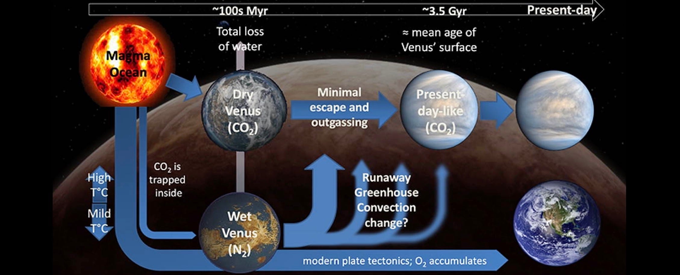
Venus is a hellscape. Its thick carbon dioxide atmosphere creates a runaway greenhouse effect causing average surface temperatures of 470 degrees Celsius—hot enough to melt lead. Venus’ inhospitable nature is further affirmed by its toxic clouds of sulfuric acid. But it wasn’t always this way.
Past missions to Venus have observed granite-like rocks that require abundant water to form. Scientists think the planet may have had liquid water on the surface for 2 billion years—far longer than Mars, which hosted surface water for a relatively brief 300 million years.
Due to its similar size and bulk composition, at some point, Venus seems to have been the most Earth-like planet in our solar system. And yet it experienced a dramatic climate shift to hell while Earth remained habitable. What geological mechanisms drove Venus to this unearthly fate? Was Venus really covered in oceans? Is water still present in Venus’ interior?
These are some of the key questions that NASA’s VERITAS mission aims to answer. VERITAS—short for Venus Emissivity, Radio science, InSAR, Topography, And Spectroscopy—will provide us with the highest resolution global maps of Venus' surface to identify specific geologic and volcanic processes that actively shape it.
The mission will also tell us how similar planets across the universe may evolve, how likely they are to host life, and how we should define habitable zones around stars.
How will VERITAS map Venus?
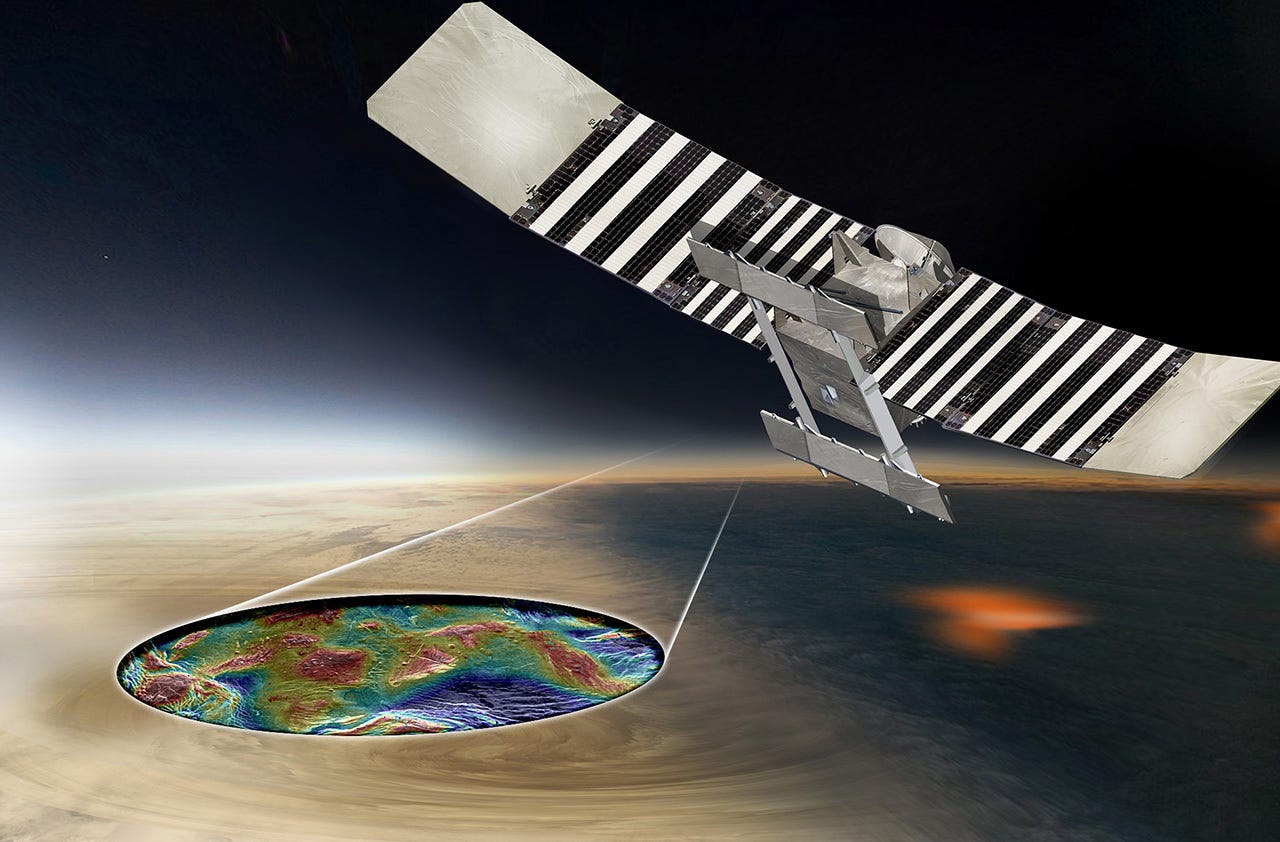
After launching no earlier than 2028, VERITAS will reach Venus about seven months later and enter orbit around the planet. Over the next year, it will use Venus’ upper atmosphere to slow down and circularize its orbit to about 250 kilometers from the planet’s surface to map Venus in detail for years.
VERITAS’ radar will map Venus’ entire surface at 30 meters/pixel—that’s at least three times higher resolution than NASA’s previous Venus mapper Magellan. The maps will finally help scientists understand how Venus’ surface changes today and how it has transformed over tens of millions of years.
VERITAS will also create coarse 3D maps of Venusian landforms at 5 meters/pixel height resolution to help scientists find hints of tectonic activity. Scientists will further scan the maps for large, buried impact basins, which might have formed around 4 billion years ago when large asteroids and comets were bombarding the inner solar system. If Venus doesn’t have several impact basins like other rocky worlds do, it means the planet’s surface has been actively reshaped for that long.
How will VERITAS find out if Venus is volcanically active?
While most planetary orbiters can use typical spectrometers to map an object’s surface, Venus’ thick clouds make it almost impossible to see its surface. However, there are specific wavelengths of infrared light Venus’ atmosphere is transparent to, and VERITAS’ infrared spectrometer will observe in exactly such windows of opportunity.
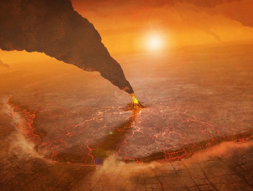
The spectrometer, provided by the German space agency, will look for local hotspots on the surface caused by active eruptions, such as glowing lakes of lava, and help confirm active volcanism and hints of the same observed by previous missions.
How will VERITAS tell us if Venus had oceans of water?
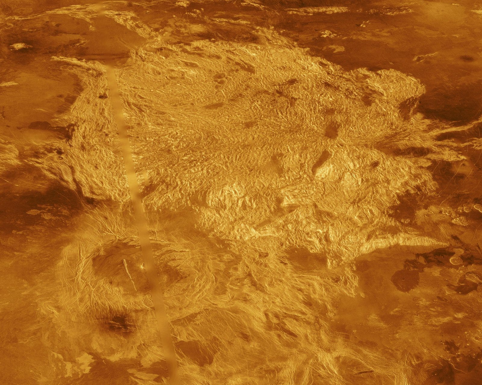
VERITAS’ infrared spectrometer will also map minerals on Venus’ surface and identify the composition of its rocks, which will tell us if some of it was really altered by abundant water as many scientists think. If not, Venus was likely never cool enough for significant amounts of water vapor in its atmosphere to condense and fall. Tesserae, one of the oldest regions on Venus, are leading candidates for this search.
Tesserae are highly deformed terrain that might move like Earth’s continents, which themselves formed when iron-rich oceanic crust plunged into Earth’s interior and melted in the presence of water to produce granitic continental plates which later rose above the ocean. VERITAS’ infrared spectrometer will identify the tesserae’s composition and tell us about their size and movement.
How will VERITAS help determine if Venus is habitable?
In 2020 scientists announced they found phosphine—a chemical strongly associated with life—in Venus' clouds 50 kilometers above the surface, where temperatures and pressures are Earth-like. Phosphine’s presence was disputed a few months later and then reclaimed in weaker but still enough amounts that volcanism alone is unlikely to explain it.
VERITAS can help clear the air. Its infrared spectrometer will detect any significant amounts of water vapor in erupted material from the planet’s interior, telling us if Venus holds substantial water below its crust like Earth does. If that’s the case, Venus’ interior isn’t chemically reduced, which is stable for water but not for substantial amounts of phosphine. So the water measurements by VERITAS will help us move the phosphine mystery forward.
How will VERITAS know what lies in Venus’ interior?
We don’t really know what Venus’ interior is like. VERITAS will help us know that by measuring Venus’ gravity field. As the spacecraft passes over denser and hollower regions of Venus, its position and velocity will be impacted by the changes in gravity. The radio communications instrument onboard, which has contributions from the French and Italian space agencies, will note these finer movements of the spacecraft, allowing scientists to infer the planet’s gravity field. This will tell us the likely size of its core, and if its mantle is as iron-rich as Earth or more or less so.
How are NASA and Europe collaborating to study Venus?
In addition to some European countries contributing instruments to VERITAS, the European Space Agency (ESA) itself is collaborating with NASA to explore Venus. While VERITAS maps Venus in 2031, ESA will launch the EnVision spacecraft to holistically study Venus’ surface, subsurface and atmosphere. NASA is providing one of the two EnVision radars as well as Earth communications support for the mission.
Since VERITAS and EnVision will be orbiting Venus at the same time, scientists from the two missions can coordinate observations to enhance the total scientific output. VERITAS’ global radar imaging will provide context to interpret EnVision’s data. And when NASA scientists find something interesting in VERITAS’ data, they can ask ESA to have EnVision take a closer look.
Moreover, in 2030 NASA will launch the DAVINCI atmospheric probe, co-selected alongside VERITAS. EnVision and VERITAS will provide context for interpreting precise trace gas measurements and tesserae images DAVINCI will take from Venus’ atmosphere. On the flip side, DAVINCI’s surface and atmospheric data will help calibrate some types of measurements by VERITAS and EnVision.
Meanwhile, India’s space agency is finalizing the configuration of its first Venus orbiter, Shukrayaan, with a radar similar to VERITAS and a comprehensive instrument suite like EnVision’s. It will launch sometime before the end of the decade on a four-year mission to study Venus’ surface, interior, and atmosphere.
Together, these missions will provide us an extremely comprehensive view of Earth’s sister planet for the first time, helping us understand the delicate physical and chemical balance that ultimately makes Earth habitable and Venus not so much. The 2030s look to be the decade of Venus.
Originally published at The Planetary Society.
Like what you read? Support me to keep me going.
